
home of the mapping community in Davis, CA
#maptimeDavis is the heart of the mapping community in Davis, CA. Our members include students, postdocs, staff, faculty, and alumni from UC Davis, as well as city residents and folks from our surrounding cities. #maptimeDavis is supported by UC Davis DataLab.
We are a community rooted in the #maptime tradition of members learning mapping technologies together. Our goal is to provide a physical and digital space to help our members engage with our community.
Workshops take place on Fridays from 10:00-12:00, unless otherwise indicated. Please note the location of each workshop. In-person workshops will typically be held in The DataLab Classroom, room 360 Shields Library. Most of our workshops will be fully in-person with no zoom option. We anticipate making videos of instructional workshops available on our YouTube Channel after the end of the quarter for those who are unable to attend in person.
Scroll down for event descriptions.
| Date | Topic | Speaker | Location |
|---|---|---|---|
| 1/16/2026 | Work Session RSVP | Community Event | DataLab Classroom - room 360 Shields Library |
| 1/23/2026 | Intro to QGIS RSVP | Lauren Mabe | DataLab Classroom - room 360 Shields Library Workshop Materials Zine Download |
| 1/30/2026 | Work Session RSVP | Community Event | DataLab Classroom - room 360 Shields Library |
| 2/6/2026 | Lightning Talks RSVP; Sign Up to Share | Coordinated by Lauren Mabe | DataLab Classroom - room 360 Shields Library |
| 2/13/2026 | Work Session RSVP | Community Event | DataLab Classroom - room 360 Shields Library |
| 2/20/2026 | Maps in R RSVP | Michele Tobias | DataLab Classroom - room 360 Shields Library Workshop Materials Zine Download |
| 2/27/2026 | Work Session RSVP | Community Event | DataLab Classroom - room 360 Shields Library |
| 3/6/2026 | Career Day RSVP | Coordinated by Naomi Kalman | DataLab Classroom - room 360 Shields Library; Summary Notes |
| 3/6/2026 12:30-1:30 | Lunch Social | Community Event | The Gunrock Pub on campus |
| 3/13/2026 | Work Session | Community Event | DataLab Classroom - room 360 Shields Library |
| Tentative SPRING 2026 SCHEDULE as of 2/11/2026 | |||
| 4/10/2026 | Work Session (RSVP link coming soon) | Community Event | DataLab Classroom - room 360 Shields Library |
| 4/17/2026 | Intro to QGIS: Rasters (RSVP link coming soon) | Lauren Mabe | DataLab Classroom - room 360 Shields Library |
| 4/24/2026 | Work Session (RSVP link coming soon) | Community Event | DataLab Classroom - room 360 Shields Library |
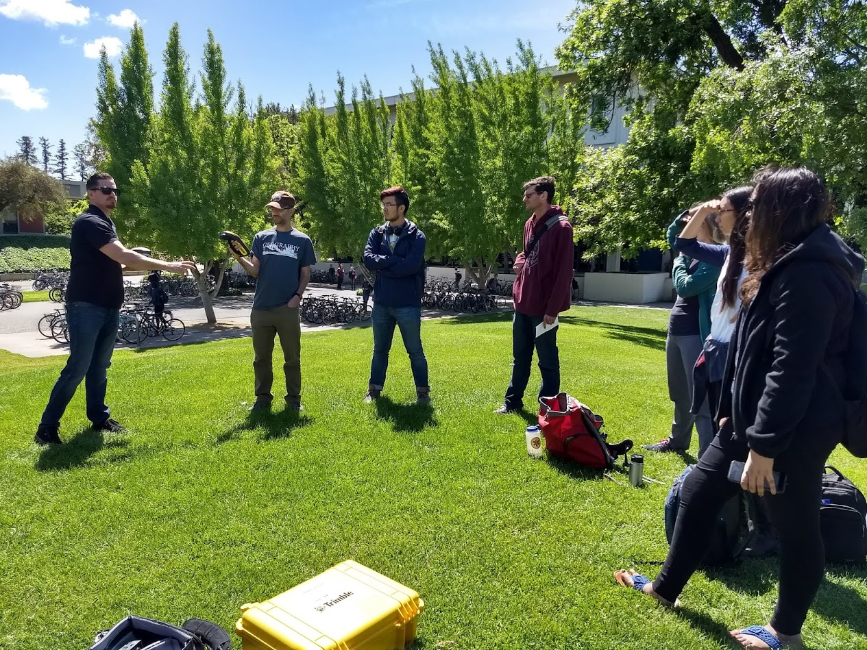
| 5/1/2026 | Field Data Collection (RSVP link coming soon) | Many (let us know if you want to share!) | DataLab Classroom - room 360 Shields Library |
| 5/8/2026 | Work Session (RSVP link coming soon) | Community Event | DataLab Classroom - room 360 Shields Library |
| 5/15/2026 | Map Design (RSVP link coming soon) | Michele Tobias | DataLab Classroom - room 360 Shields Library |
| 5/22/2026 | Work Session (RSVP link coming soon) | Community Event | DataLab Classroom - room 360 Shields Library |
| 5/29/2026 | Spatial SQL (RSVP link coming soon) | Alex Mandel, Naomi Kalman, Michele Tobias, Holden Tal | DataLab Classroom - room 360 Shields Library |
Date: 1/16/2026
Location: DataLab Classroom - room 360 Shields Library
Description: People working with geospatial data and methods are scattered across campus. Wouldn’t it be nice to work on your geospatial projects around peers who actually understand what you’re doing? Come work in the same space with other geo people, get feedback, ask questions, and answer questions.
Concepts Covered: Coworking, Getting Help, Making Progress, Crossing Things Off the To-Do list
Speaker: Community
Prerequisites: No prior experience is required.
Software Required: Bring what you need.
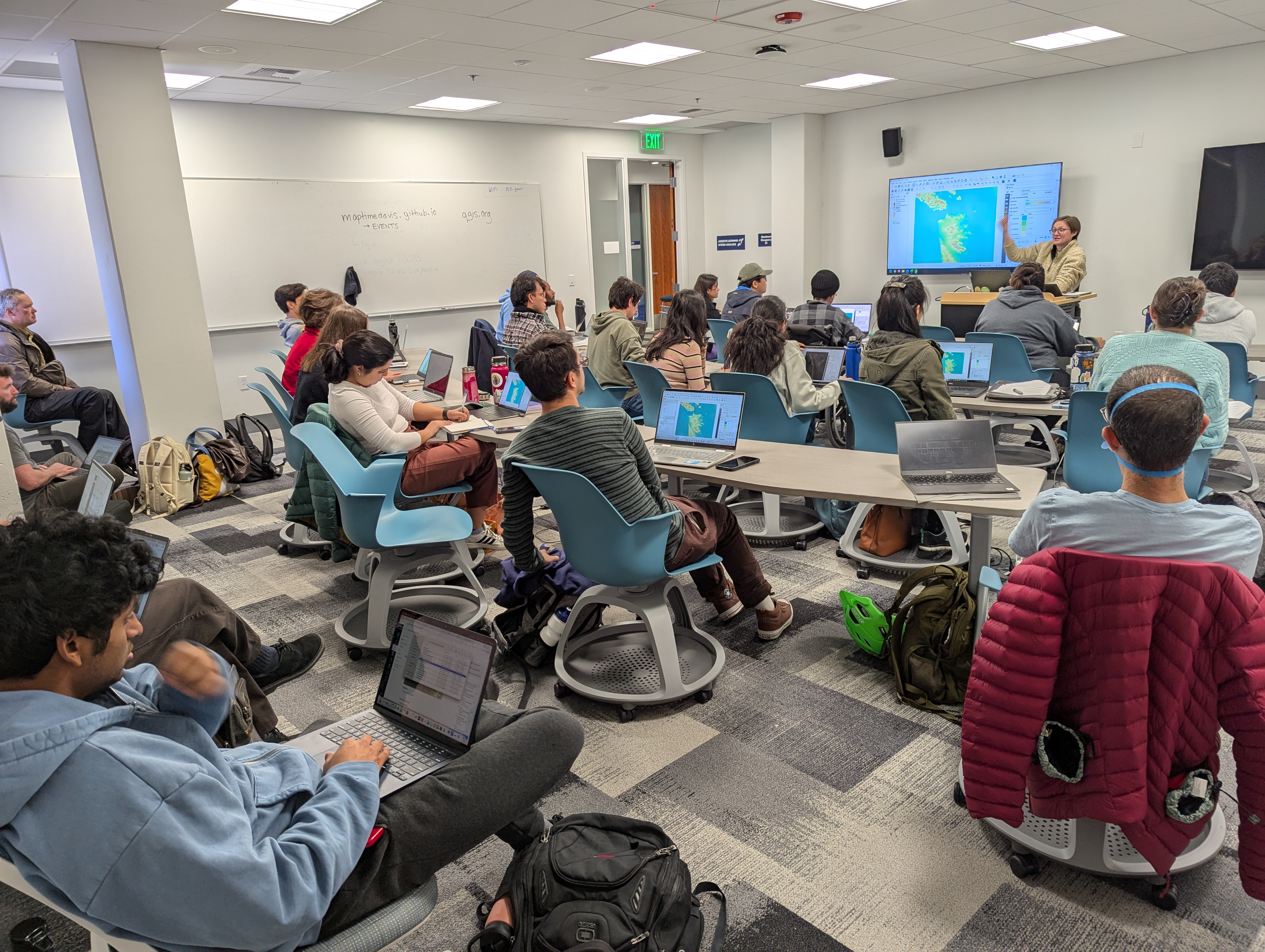
Date: 1/23/2026
Location: DataLab Classroom - room 360 Shields Library
Description: This introductory-level workshop will focus upon the fundamental concepts and skills needed to explore and analyze data using Geographic Information Systems (GIS) software with examples using the QGIS platform.
By the end of this workshop, you will be able to: -Define GIS and geospatial concepts and terminology. -Know the difference between vector and raster data types -Properly connect and add data to a QGIS project -Know where to find the attributes of your data in QGIS -Perform basic selections and queries in QGIS -Symbolize data by attributes -Assemble a basic map for export
Concepts Covered: Graphical User Interface GIS; Vector Data; Raster Data; Data Visualization; QGIS
Speaker: Lauren Mabe & Holden Tal
Lauren is a PhD Candidate in the Geography Graduate Group and previously worked as a cartographer for Garmin Intl. Her research focuses on sustainable organic waste management systems in California. She uses many geospatial tools in her work and is passionate about good maps in research! Holden is an undergraduate student studying Sustainable Environmental Design and Community and Regional Development. He is currently a geospatial intern at Datalab in Shields Library UC Davis.
Prerequisites: No prior experience with QGIS or other GIS software is needed, though attendees should be comfortable learning new computer applications, working with the basics of spreadsheets, and managing, organizing, and moving computer files on their operating system.
Software Required: You should download and install QGIS (the latest long term release or newer) on your computer. QGIS is avaialble for free from qgis.org for Mac, Windows, and Linux operating systems. The data we'll use in this workshop is available in this Box Folder Online.
Date: 1/30/2026
Location: DataLab Classroom - room 360 Shields Library
Description: People working with geospatial data and methods are scattered across campus. Wouldn’t it be nice to work on your geospatial projects around peers who actually understand what you’re doing? Come work in the same space with other geo people, get feedback, ask questions, and answer questions.
Concepts Covered: Coworking, Getting Help, Making Progress, Crossing Things Off the To-Do list
Speaker: Community
Prerequisites: No prior experience is required.
Software Required: Bring what you need.
Date: 2/6/2026
Location: DataLab Classroom - room 360 Shields Library
Description: Lightning Talks are short presentations meant to spark discussion and collaboration across the UC Davis geospatial community. Each speaker will have maximum 5 minutes to share what they’ve been working on. A cool map, a fresh spatial dataset, an idea you want to crowdsource, anything mapping and spatial related is welcome! Does it need to be a finished project? NO! Works in progress are encouraged! You can think of this as research show-and-tell; a time to share your progress, get new ideas, or learn more about research happening on campus!
Concepts Covered:
Speaker: Coordinated by Lauren Mabe
Lauren is a PhD Candidate in the Geography Graduate Group. Her research focuses on sustainable organic waste management systems in California.
Prerequisites: Given the visual nature of maps, participants often prepare a short presentation (3-5 slides), but this is not required! Feel free to use other visual aids or none at all. Presenting in the Lightning Talk is not required, this is a great time to listen and learn about all things geospatial. If you are presenting a Lightning Talk, please use this form to sign up (https://forms.gle/BvARbTW9veJKa3XL6). We will reach out week-of to gather slides/presentations to ensure to session runs smoothly
Software Required:
Date: 2/13/2026
Location: DataLab Classroom - room 360 Shields Library
Description: People working with geospatial data and methods are scattered across campus. Wouldn’t it be nice to work on your geospatial projects around peers who actually understand what you’re doing? Come work in the same space with other geo people, get feedback, ask questions, and answer questions.
Concepts Covered: Coworking, Getting Help, Making Progress, Crossing Things Off the To-Do list
Speaker: Community
Prerequisites: No prior experience is required.
Software Required: Bring what you need.
Date: 2/20/2026
Location: DataLab Classroom - room 360 Shields Library
Description: In this workshop, participants will learn how to use several options for composing maps in R.
After completing this chapter, learners should be able to: Apply popular mapping workflows to create maps with spatial data; assess which workflow works best in different situations; apply cartographic best practices to a map composition in R
Concepts Covered: R, Cartography, Programming, Data Vizualization
Speaker: Michele Tobias
Michele Tobias is a geospatial data scientist with a background in geospatial methods for ecology. Michele earned her PhD from UC Davis in Geography where she studied California’s sandy beach ecosystem with traditional phytosociological methods and innovative remote sensing tools and was a postdoc at the UC Davis Information Center for the Environment. In her current position as a geospatial data scientist at UC Davis DataLab, she applies geospatial tools to new avenues of research across disciplines.
Prerequisites: For the best experience, we recommend learners have the following skills before taking this workshop: an introductory understanding of programming in R (for example, you are familiar with how to load libraries, load common data formats like a CSV, and are comfortable running basic commands). See DataLab’s R Basics Workshop for help; an introductory understanding of spatial data (for example, you are familiar with the difference between raster and vector data). See DataLab’s ,a href="https://ucdavisdatalab.github.io/workshop_spatial_data_formats/">Spatial Data Formats Workshop</a> for help; (recommended) review the concepts (first section) of DataLab’s Cartography for Academic Publications Workshop
Software Required: To fully participate in this workshop, learners should download and install R and RStudio on their laptop before the workshop begins.
Date: 2/27/2026
Location: DataLab Classroom - room 360 Shields Library
Description: People working with geospatial data and methods are scattered across campus. Wouldn’t it be nice to work on your geospatial projects around peers who actually understand what you’re doing? Come work in the same space with other geo people, get feedback, ask questions, and answer questions.
Concepts Covered: Coworking, Getting Help, Making Progress, Crossing Things Off the To-Do list
Speaker: Community
Prerequisites: No prior experience is required.
Software Required: Bring what you need.
Date: 3/6/2026
Location: DataLab Classroom - room 360 Shields Library
Description: This question and answer session will allow participants to ask questions about applying for jobs and working in the geospatial field at a variety of institutions.
Concepts Covered: Careers
Speaker: Coordinated by Naomi Kalman
Guest speakers will include geospatial professionals working in state, federal, and local government; private industry; and research universities. Join us for a no-host lunch at Gunrock Pub (UCD Silo) after the event.
Prerequisites: No prior experience is required.
Software Required: No software is required.
Date: 3/6/2026
Location: DataLab Classroom - room 360 Shields Library
Description:
Concepts Covered: Networking, Socializing
Speaker:
Directly following the Career Day session, we'll walk over to the Gunrock Pub on campus at the Silo to have a relaxed (no host) lunch and continue our discussion of geospatial careers. Join us whether or not you could come to the Career Day event.
There are many ways to participate in #maptimeDavis. Here are some suggestions:
Attend events. See the Events page for the current #maptimeDavis Workshop Schedule.
Help at a workshop. Making workshops run smoothly is a team effort. We often need folks to help answer questions, relay communications to the presenter, or help participants who get stuck.
Present a workshop. You don't need to be an expert to teach well.
Join #maptimeDavis Council, the group of people who organize each quarter's events.
Please send questions to Michele Tobias - mmtobias@ucdavis.edu
![]()
T-shirts and other #maptimeDavis branded items are available at cost (no markup) from Redbubble. Available logos include black, white, gray, and rainbow.
Since it began in 2017, #maptimeDavis’s mission is to provide a welcoming community for people with an interest in spatial data to learn together. We value learners of all skill levels and software experience.
In a practical sense, the goal of #maptimeDavis is to connect spatial data practitioners to colleagues doing similar work so that while people may be the only person in their lab, graduate program, or office doing spatial work, they are not alone on campus or in the community.
#maptimeDavis is a learning community focused on instructor-lead formal workshops teaching a specific skills. These workshops typically (but not always) require participants to bring a laptop computer with software installed pertaining to the topic of the workshop. If a particular software is needed for a workshop, we’ll let you know what you need before hand if you register.
In the summer of 2021, the Spatial Sciences Research & Learning Cluster recruited community members to help advise and produce our #maptimeDavis workshop series. We assembled a team with a variety of skills and interests including students, staff, and faculty. This year's #maptimeDavis Council members are:
Matthew Conner, Librarian, UC Davis Library (since 2021)
Naomi Kalman, GIS Programmer, UC Davis Campus and Environmental Planning (since 2021)
Lauren Mabe, Graduate Student, UC Davis Geography Graduate Group (since 2024)
Alex Mandel, Geospatial Engineer, Development Seed (since 2017, founding member)
Holden Tal, Undergraduate Student, UC Davis Sustainable Environmental Design (since 2025)
Michele Tobias, Data Scientist, UC Davis DataLab (since 2017, founding member)
We thank the past council members for all of their work!
Karen Beardsley, Staff/Faculty, UC Davis Global Affairs (2021-2023)
Liam Bhajan, Graduate Student, UC Davis Geography Graduate Group (2023-2024)
Emma Forester, Graduate Student, UC Davis Geography Graduate Group (2022-2023)
Kyra Liu, Undergraduate Student, UC Davis Environmental Science and Management (2023-2024)
Lupe Franco, Graduate Student, UC Davis Geography Graduate Group (2023-2024)
Sadia Gul, Graduate Student, UC Davis Energy Graduate Group (2021-2022)
Veronica Herrera, Graduate Student, UC Davis Geography Graduate Group (2022-2024)
Mina Rezaei, Graduate Student, UC Davis Geography Graduate Group (2021-2022)
We are always looking for volunteers to join our efforts! If you are interested in joining #maptimeDavis Council, please email Michele Tobias - mmtobias@ucdavis.edu
We do our best to make the materials from past workshops available. Whenever possible, we collect the written materials such as workshop notes, guides, or tutorials, and make them available. Since 2020, we have made a concerted effort to record workshops and post them on our YouTube Channel.
As you might expect, we don't have everything. If we are missing something and you know where we can find it, please let us know by writing an issue on our GitHub repository for this website.
Below is a list of past workshops and their associated videos and materials.
| Date | Topic | Speaker | Materials |
|---|---|---|---|
| 11/14/2025 | Into to GIS in R | Elise Hellwig | Workshop Materials, Video |
| 10/31/2025 | Hand Drawn Maps - Halloween Edition | Michele Tobias | Workshop Reference Maps; Written Materials; Video |
| 10/17/2025 | GIS & Facilities Management | Federico Albarracin | Workshop Materials, Video |
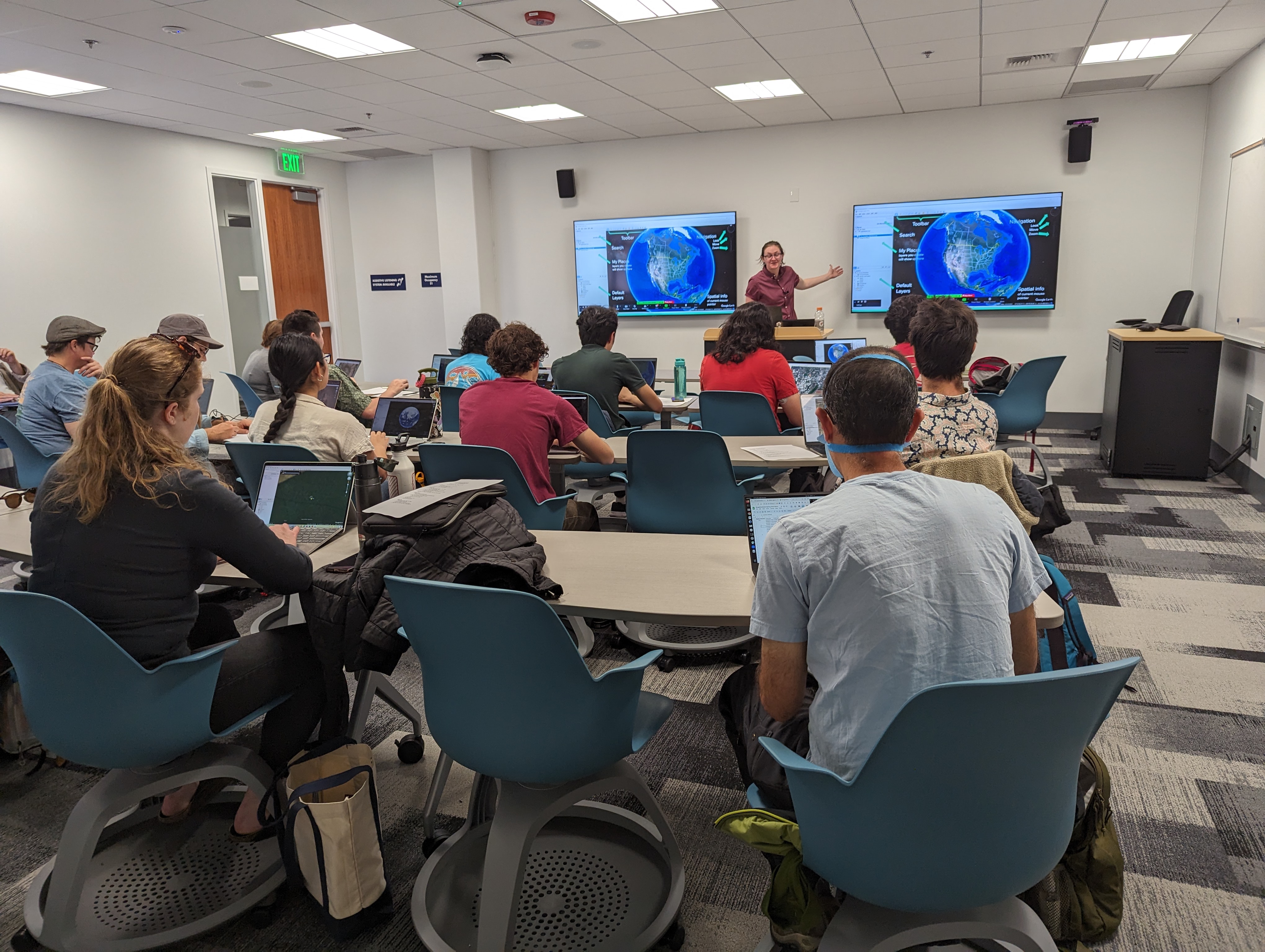
| 10/3/2025 | Google Earth online | Lauren Mabe | Workshop Materials, Video |
| 5/2/2025 | Next Steps with QGIS | Lauren Mabe, Geography Graduate Group | Workshop Materials |
| 4/18/2025 | Hand Drawn Maps | Michele Tobias, DataLab | Workshop Materials; Video |
| 2/14/2025 | Finding Spatial Data | Community Discussion | Workshop Materials |
| 1/17/2025 | Intro to QGIS | Lauren Mabe | Workshop Materials |
| 11/15/2024 | Contributing to OpenStreetMap | Naomi Kalman, Campus Planning and Environmental Stewardship | Workshop Slides |
| 11/1/2024 | Lightning Talks | Organizer: Lauren Mabe, Geography Graduate Group | Slides coming soon! |
| 10/18/2024 | Intro to Making Maps with Google Earth Pro | Lauren Mabe, Geography Graduate Group | Download Google Earth Pro; Written Materials |
| 10/4/2024 | Intro to Spatial Data Formats (RSVP Here) | Michele Tobias, UC Davis DataLab | Written Materials |
| 5/31/2024 | Spatial R: Migrating from Raster to Terra | Elise Hellwig (UC Davis) | Video, Workshop Materials |
| 5/17/2024 | Exploring the National Zoning Atlas | Clancy McConnell (UC Davis) | Video |
| 5/3/2024 | Spatial SQL | Michele Tobias (UC Davis) | Workshop Materials |
| 4/26/2024 | Intro to ArcPro | Naomi Kalman (Valley Spatial) | Video, Workshop Materials |
| 4/19/2024 | Intro to GIS with QGIS | Veronica Herrera (UC Davis) | Workshop Materials |
| 4/12/2024 | Intro to Mapping with Google Earth | Lauren Mabe (UC Davis) | Video, Workshop Materials; Slides; Download Google Earth Pro |
| 3/8/2024 | Photogrammetry & Working with Aerial Imagery | Michele Tobias & Liam Bhajan (UC Davis) | Workshop Materials Video |
| 3/1/2024 | Practicing Critical GIS in the Era of Big Data and AI | Charles Knoble | Video |
| 2/23/2024 | OpenStreetMap | Vanessa Knoppke-Wetzel (GreenInfo Network) | Talk Slides Video |
| 2/13/2023 | Developing Your Data Science Portfolio | Michele Tobias (UC Davis DataLab) | Workshop Materials |
| 2/9/2024 | ArcPro and QGIS side by side overview | Naomi Kalman (Valley Spatial) | Workshop Materials Video |
| 1/26/2024 | Downloading Satellite Data from Spatiotemporal Asset Catalogs (STAC) using R ) | Michele Tobias (UC Davis DataLab) & Alex Mandel (Development Seed) | Workshop Materials Video |
| 12/1/2023 | GreenInfo Network and the 30x30 Initiative for conserving California | Dariya Draganova, GreenInfo Network | Video |
| 11/17/2023 | Happy Birthday, #maptimeDavis! Job Panel + Cake! | Panel Discussion | Video |
| 11/3/2023 | A nexus of methods for bees in the gentrifying city: Using GIS, urban political ecological theory, and field ecology to uncover connections between changing property values and urban bee diversity. | Austin Martin | Video |
| 10/20/2023 | Integrating Survey123 Connect and Dashboards | Heather Witzens, CAL FIRE | Video |
| 10/6/2023 | UC Davis CRC California General Plan Database Mapping Tool | Dr. Catherine Brinkley, UC Davis | Video |
| 5/23/2023 | Get Started with Drones in Scientific Research | Clancy McConnell | Video, Slides |
| 5/16/2023 | Intro to GIS with QGIS | Michele Tobias | Video, Written Tutorial |
| 5/2/2023 | Building Web Maps with Leaflet | Naomi Kalman | Video, Written Tutorial |
| 3/7/2023 | ESRI StoryMaps | Emma Forester | Video |
| 2/21/2023 | Webhooks | Carlos Barahona | Video |
| 2/14/2023 | Digital Portfolios for Data Science | Michele Tobias | Video, Written Tutorial |
| 2/7/2023 | Multispectral Kite Aerial Photography & Photo Processing | Michele Tobias | Video |
| 1/24/2023 | Tactile Campus Map | Joshua Hori | Video |
| 11/15/2022 | Cartography for Map Figures in Academic Journals & Books | Michele Tobias | Video, Written Tutorial |
| 11/1/2022 | Introduction to Google Earth Engine | Luke Salvato | Video |
| 10/25/2022 | Introduction to Geospatial Raster and Vector Data with Python | Ryan Avery | Video |
| 10/18/2022 | ArcGIS Insights for iterative and exploratory data analysis | Karen Beardsley | Video |
| 9/27/2022 | Hood Canal Landscape Assessment and Prioritization Tool (HC-LAP): A Web Mapping Application to Support Conservation Efforts in Hood Canal (Washington) | David Puckett | Video |
| 5/24/2022 | Mapping Tools for Policy Decisions | Nathaniel Roth | Video |
| 5/17/2022 | Intro to Google Earth Engine | Luke Salvato | Video |
| 5/10/2022 | Spatial SQL | Michele Tobias | Video, Written Tutorial |
| 5/3/2022 | Engaging Underserved Communities through GIS Mapping | Angelina Rahimi & Vosawale Lesuma (Aora Planning) | Video |
| 4/26/2022 | Working with Cal-Adapt Climate Data in R | Andy Lyons (UC ANR) | Video |
| 4/12/2022 | Intro to GIS with QGIS | Michele Tobias | Video |
| 2/22/2022 | Engage your community with ArcHub | Carlos Barahona | Video |
| 2/15/2022 | Web Maps with Leaflet | Michele Tobias | Video |
| 2/8/2022 | Maps with D3 | Mina Rezaei | Video |
| 11/16/2021 | Introduction to Desktop GIS with QGIS | Michele Tobias | Video |
| 11/9/2021 | Intro to PostGIS (Crunchy Data Tutorial) | Steve Pousty | Tutorial: PostGIS for Newbies |
| 11/2/2021 | ArcGIS Field Maps (Esri) | Miriam Schmidts and Canserina Kurnia | Video |
| 10/26/2021 | Intro to ArcGIS Online | Karen Beardsley | Video |
| 10/19/2021 | Shiny Apps for Geospatial Data | Taylor Nelsen | Video |
| 10/12/2021 | Is my research mappable? | Michele Tobias | Video |
| 10/5/2021 | Reading NetCDF as Zarr | Lucas Sterzinger | Video |
| 18-May-21 | Lightning Talks | Evlyn Pless (Organizer) & the Community | |
| 11-May-21 | Art Software for Cartography & Other Visual Research Communication (Studio Discussion) | Michele Tobias & the Community | |
| 4-May-21 | Introduction to Spatial Statistics in R | Wesley Brooks | Video |
| 27-Apr-21 | Projected Coordinate Systems in R | Michele Tobias | Video |
| 20-Apr-21 | Agent-Based Modeling with NetLogo | Sarah Grajdura | Video |
| 13-Apr-21 | End-to-end Deep Learning Workflows using Geospatial Technology | David Yu, ESRI | Video |
| 6-Apr-21 | Simplified Volcano Hazards Maps: Lessons Learned and Future Directions | David Ramsey, U.S. Geological Survey and USAID, Cascades Volcano Observatory | Video |
| 23-Feb-21 | Getting started with the new ArcGIS Field Maps | Canserina Kurnia & Mark Stewart, ESRI | Video |
| 16-Feb-21 | #maptimeDavis Studio: Working with Address Data | Community Discussion | |
| 9-Feb-21 | Geocoding Address Data: Approaches to Personally Identifiable Data | Michele Tobias | Video |
| 19-Jan-21 | #maptimeDavis Studio: Future of #maptimeDavis | Community Discussion | |
| 12-Jan-21 | Earth Engine & R for presentation-quality contextual maps | Christian John | Video |
| 1-Dec-20 | Mapping in R | community | |
| 24-Nov-20 | From Spatial Data to Publication Ready Figure: Mapmaking with R | Ryan Peek | Video |
| 17-Nov-20 | Machine Learning for Spatial Data | community | |
| 10-Nov-20 | Crop Type Mapping with Deep Learning using Tensor Flow | Alex Mandel & Lily Thomas, Development Seed | Video |
| 3-Nov-20 | Map Design & Cartography | community | |
| 27-Oct-20 | Journal Map Figure Design | Michele Tobias | Video |
| 20-Oct-20 | OpenStreetMap Data | community | |
| 13-Oct-20 | Contributing Geographic Data Through OpenStreetMap (OSM) | Gaurav Thapa | |
| 6-Oct-20 | The Year of the Map: The importance of Spatial Data in 2020 | Leah Nagel | |
| 2-Jun-20 | Spatial Sciences Research Cluster | --- | |
| 26-May-20 | Humanitarian OpenStreetMap Mapathon | community | |
| 19-May-20 | Spatial Sciences Research Cluster | --- | |
| 12-May-20 | Mapbox | Megan Danielson, mapbox | |
| 5-May-20 | Spatial Sciences Research Cluster | --- | |
| 28-Apr-20 | R for Spatial | Leah Nagel | |
| 21-Apr-20 | Spatial Sciences Research Cluster | --- | |
| 14-Apr-20 | Intro to GIS with QGIS | Michele Tobias | |
| 7-Apr-20 | Spatial Sciences Research Cluster | --- | |
| 10-Mar-20 | Participatory Mapping With Field Papers | Nina Fontana & Michele Tobias | |
| 3-Mar-20 | Spatial Science Research Cluster | --- | |
| 25-Feb-20 | Drone imagery processing using Agisoft Metashape: single-workstation and high-performance computing cluster applications | Mallika Nocco & Derek Young | |
| 18-Feb-20 | Spatial Science Research Cluster | --- | |
| 11-Feb-20 | Planet Satellite Data with QGIS Plugin | Planet’s Staff | |
| 4-Feb-20 | Spatial Science Research Cluster | --- | |
| 28-Jan-20 | ESRI Resources on Campus | Karen Beardsley | |
| 21-Jan-20 | Spatial Science Research Cluster | --- | |
| 14-Jan-20 | Finding Historical Air Photos with UCSB's FrameFinder | Dawn Collings | |
| 7-Jan-20 | Spatial Science Research Cluster | --- | |
| 11/26/2019 | Research Cluster | --- | |
| 11/20/2019 | Spatial SQL | Michele Tobias | |
| 11/19/2019 | NASA Develop Program | Jose Ochoa | |
| 11/12/2019 | Research Cluster | --- | |
| 11/6/2019 | Intro to SQL (non-spatial) | Michele Tobias | |
| 11/5/2019 | Map Collection & Library Map Data Projects | Dawn Collings | |
| 10/29/2019 | Research Cluster | --- | |
| 10/22/2019 | Cloud-computing for large geospatial datasets | Lauren Mabe | |
| 10/15/2019 | Research Cluster | --- | |
| 10/8/2019 | AI-Assisted Mapping: Using Facebook's RapiD OSM Editor | Cameron Denney, Kaart @ Facebook | |
| 10/1/2019 | Research Cluster | --- | |
| 16-Aug-19 | Geocoding | Michele Tobias | |
| 4-Jun-19 | Introduction to Python in ArcGIS Pro & ArcGIS R-Bridge | Matthew Twietmeyer, ESRI | |
| 28-May-19 | GIS Career Panel Discussion | Center for Spatial Sciences | |
| 21-May-19 | Getting Started with ArcGIS Pro | Matthew Twietmeyer, ESRI | |
| 14-May-19 | Historical Mapping with Open Source Tools | Emily Merchant & Michael Mortimer | |
| 7-May-19 | Drone Show & Tell | Center for Spatial Sciences | |
| 30-Apr-19 | Intro to GIS with QGIS | Michele Tobias | |
| 23-Apr-19 | NDVI Time Series Data in R | Mahesh Maskey & Kristen Shapiro | |
| 16-Apr-19 | Humanitarian OpenStreetMap Mapathon | Mapping Club | |
| 6-Mar-19 | Fire Mapping | Yufang Jin’s Lab | |
| 27-Feb-19 | Field Data Collection | Derek Young, Sierra Mabanta, Huck Rees, & Ofuhre Igbinedion | |
| 22-Feb-19 | Geospatial Data Visualization | Michele Tobias | |
| 20-Feb-19 | Lightning Talks | Geospatial Community | |
| 13-Feb-19 | Python for Field Calculations in QGIS and ArcGIS | Nick Santos | |
| 6-Feb-19 | Spatial Networks in R | Beatriz Martinez-Lopez’s Lab | |
| 30-Jan-19 | Interactive Maps with R | Alex Mandel, Nistara Randhawa, Ryan Peek, & Mahesh Maskey | |
| 23-Jan-19 | 1 Hour Map Challenge! | Center for Spatial Sciences | |
| 16-Jan-19 | Mapathon | Sierra Mabanta | |
| 4-Dec-18 | Finishing touches: how to create polished and professional-looking maps in ArcGIS | Amber Manfree | |
| 2-Dec-18 | Data Fusion in Remote Sensing | Yufang Jin's Lab | |
| 14-Nov-18 | Special GIS Day Event: Women in GIS Meetup | Shannon DeArmond | |
| 5-Nov-18 | Open Source Cartography | Michele Tobias | |
| 29-Oct-18 | Spatial SQL | Michele Tobias | |
| 22-Oct-18 | Analyzing Drone Data | Taylor Nelsen | |
| 15-Oct-18 | Into to R Spatial | Robert Hijmans | |
| 12-Oct-18 | Special Event: Install Fest | DSI & Center for Spatial Sciences | |
| 8-Oct-18 | Intro to QGIS | Sierra Mabanta | |
| 1-Oct-18 | Humanitarian Open Street Map Mapathon | The Geospatial Community | |
| 29-May-18 | RSpatial.org Species Distributions(Big Foot Example) | Elise Hellwig | |
| 22-May-18 | Remote Sensing with Planet | Orestis Herodotou (Planet) | |
| 15-May-18 | Collecting Location Data with Phones and Tablets | Alex Mandel | |
| 8-May-18 | Open Street Map Mapathon | Emily Hurry | |
| 1-May-18 | Learn to High Performance Compute: Geo style | Alex Mandel | |
| 24-Apr-18 | Mapping Surface Water Change with Earth Engine | Ani Ghosh | |
| 17-Apr-18 | Field Work Prep: Craft Center Tour + GPS Demonstration + Discussion | Jared Tolla (UCD Craft Center) & Scott Herbert (California Survey & Drafting Supply) | |
| 10-Apr-18 | Is My Research Mappable? Intro to map-making & GIS for researchers | Michele Tobias & Matt Conner | |
| 7-Mar-18 | Spatial Databases | Michele Tobias | |
| 28-Feb-18 | Finding Remote Sensing Data | Ani Ghosh | |
| 21-Feb-18 | Open Mic: many short presentations | Geospatial Community | |
| 14-Feb-18 | Open Street Map Mapathon | Geospatial Community | |
| 7-Feb-18 | Drone Image Stitching | Taylor Nelsen & Travis Parker | |
| 31-Jan-18 | Data Visualization with QGIS | Michele Tobias | |
| 24-Jan-18 | Python for Geospatial | Travis O’Brien | |
| 17-Jan-18 | ArcGIS Resources on Campus | Karen Beardsley | |
| 4-Dec-17 | Using Open Street Map Data | Ani Ghosh | |
| 27-Nov-17 | Making Maps in R | Ryan Peek | |
| 13-Nov-17 | Open Street Map Map-a-Thon | Mapping Club | |
| 6-Nov-17 | Cartography Panel & Clinic | Amber Manfree, Sahoko Yui, & Michele Tobias | |
| 30-Oct-17 | Viewing Data in ArcGIS | Mapping Club | |
| 23-Oct-17 | UAV/Drone Show & Tell | UAV Club | |
| 16-Oct-17 | Intro to Spatial R with RSpatial.org | Alex Mandel | |
| 9-Oct-17 | Google Earth Engine | Pepe Ochoa & Kate Tiedeman | |
| 2-Oct-17 | Custom Cartographic Symbols | Michele Tobias | |
| 25-Sep-17 | Intro to QGIS | Michele Tobias |